Sunauli To Muktinath Road Guide | Distance & Altitude
By Nepal Tourist Vehicle 25 Sep 2026
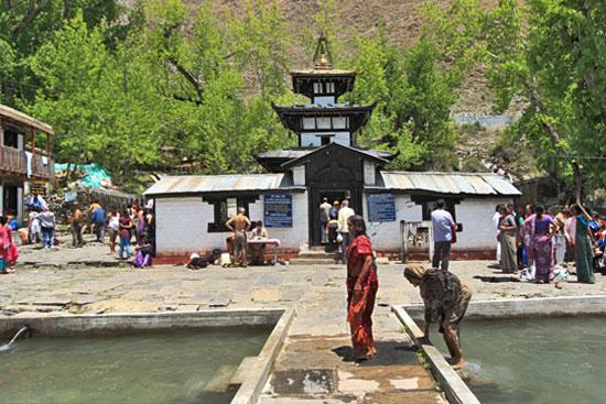
Plan your overland journey from the Sunauli–India Nepal border to Muktinath with our complete 2026 road guide. This detailed route follows Sunauli, Bhairahawa, Butwal, Tansen, Pokhara, Kusma, Beni, Tatopani, Ghasa, Marpha, Jomsom, Kagbeni and Muktinath, covering approximately 380–400 km.
The guide includes road distance, estimated driving time, altitude, major stops, recommended itinerary, vehicle options, road conditions and practical travel advice. The journey gradually rises from around 100 metres at Sunauli to approximately 3,800 metres at Muktinath, making proper planning especially important for travellers and pilgrims.
Whether you are travelling by private car, tourist vehicle, 4WD jeep or as part of a pilgrimage and sightseeing tour, this guide provides practical information for planning a safe and comfortable journey from the India–Nepal border to the sacred Muktinath Temple in Mustang.
Sunauli Border to Muktinath Road Guide 2026
India–Nepal Border to Muktinath Overland Journey
Main route:
Sunauli → Bhairahawa → Butwal → Tansen → Pokhara → Kusma → Beni → Tatopani → Ghasa → Lete → Marpha → Tukuche → Jomsom → Kagbeni → Muktinath
The total road distance is approximately 380–400 km, depending on the exact route, road diversions and current conditions.
Complete Route, Distance, Driving Time & Altitude
| No. | Route / Destination | Approx. Distance | Approx. Driving Time | Approx. Altitude |
|---|---|---|---|---|
| 1 | Sunauli Border | — | — | ~100 m |
| 2 | Sunauli → Bhairahawa | 25–30 km | 45 min–1 hr | ~105 m |
| 3 | Bhairahawa → Butwal | 25–30 km | 45 min–1 hr | ~150 m |
| 4 | Butwal → Tansen | ~65 km | 2–3 hrs | ~1,350 m |
| 5 | Tansen → Waling | ~60 km | 2–3 hrs | ~750 m |
| 6 | Waling → Pokhara | ~65 km | 2–3 hrs | ~820 m |
| 7 | Pokhara → Kusma | ~55 km | 2–3 hrs | ~550 m |
| 8 | Kusma → Beni | ~25 km | 1 hr | ~830 m |
| 9 | Beni → Tatopani | ~40 km | 2–3 hrs | ~1,200 m |
| 10 | Tatopani → Ghasa | ~20 km | 1.5–2 hrs | ~2,000 m |
| 11 | Ghasa → Lete | ~15 km | 1 hr | ~2,480 m |
| 12 | Lete → Marpha | ~25 km | 1.5–2 hrs | ~2,670 m |
| 13 | Marpha → Tukuche | ~10 km | 30–45 min | ~2,590 m |
| 14 | Tukuche → Jomsom | ~20 km | 1 hr | ~2,720 m |
| 15 | Jomsom → Kagbeni | ~10–12 km | 30–60 min | ~2,800 m |
| 16 | Kagbeni → Muktinath | ~15–20 km | 1–1.5 hrs | ~3,800 m |
| Total | Sunauli → Muktinath | ~380–400 km | 3–5 days recommended | ~3,800 m |
Distances and driving times are approximate and can change significantly because of road conditions, weather, traffic, landslides and temporary restrictions.
Major Altitude Points
| Destination | Approx. Altitude |
|---|---|
| Sunauli | ~100 m |
| Bhairahawa | ~105 m |
| Butwal | ~150 m |
| Tansen | ~1,350 m |
| Pokhara | ~820 m |
| Beni | ~830 m |
| Tatopani | ~1,200 m |
| Ghasa | ~2,000 m |
| Lete | ~2,480 m |
| Marpha | ~2,670 m |
| Tukuche | ~2,590 m |
| Jomsom | ~2,720 m |
| Kagbeni | ~2,800 m |
| Ranipauwa/Muktinath | ~3,800 m |
Altitude progression
Sunauli 100 m → Pokhara 820 m → Beni 830 m → Tatopani 1,200 m → Ghasa 2,000 m → Jomsom 2,720 m → Kagbeni 2,800 m → Muktinath 3,800 m
This is important because the journey starts almost at sea-level conditions and finishes at approximately 3,800 metres.
Recommended 5-Day Road Itinerary
Day 1: Sunauli → Pokhara
Sunauli → Bhairahawa → Butwal → Tansen → Waling → Pokhara
- Distance: approximately 185–200 km
- Driving: approximately 7–9 hours
- Overnight: Pokhara
- Altitude: ~820 m
Day 2: Pokhara → Tatopani
Pokhara → Kusma → Beni → Tatopani
- Distance: approximately 120–130 km
- Driving: approximately 5–7 hours
- Overnight: Tatopani
- Altitude: ~1,200 m
Enjoy the natural hot springs if time permits.
Day 3: Tatopani → Jomsom
Tatopani → Ghasa → Lete → Marpha → Tukuche → Jomsom
- Distance: approximately 90 km
- Driving: approximately 5–7 hours
- Overnight: Jomsom
- Altitude: ~2,720 m
This is one of the most scenic sections of the journey.
Day 4: Jomsom → Kagbeni → Muktinath
Jomsom → Kagbeni → Khingar → Jharkot → Ranipauwa → Muktinath
- Distance: approximately 30 km
- Driving: approximately 2–3 hours
- Visit Muktinath Temple
- Overnight: Muktinath/Ranipauwa
- Altitude: ~3,800 m
Allow additional time for the temple, 108 water spouts, Jwala Mai and surrounding Buddhist sites.
Day 5: Muktinath → Jomsom → Pokhara
Return through:
Muktinath → Kagbeni → Jomsom → Marpha → Tatopani → Beni → Kusma → Pokhara
Depending on road and weather conditions, this is a long driving day. An overnight stop at Jomsom, Marpha or Tatopani can be considered for a more relaxed itinerary.
Important 2026 Travel Advice
The Butwal–Tansen and Beni–Jomsom–Muktinath sections are mountain roads and can be affected by:
- Monsoon rain
- Landslides
- Rockfall
- Flooding
- Snow
- Road construction
- Temporary traffic restrictions
- River crossings
- Poor visibility
For the upper Mustang section, a 4WD jeep with an experienced local mountain driver is recommended, particularly during periods of unstable weather.
Best practical vehicle arrangement
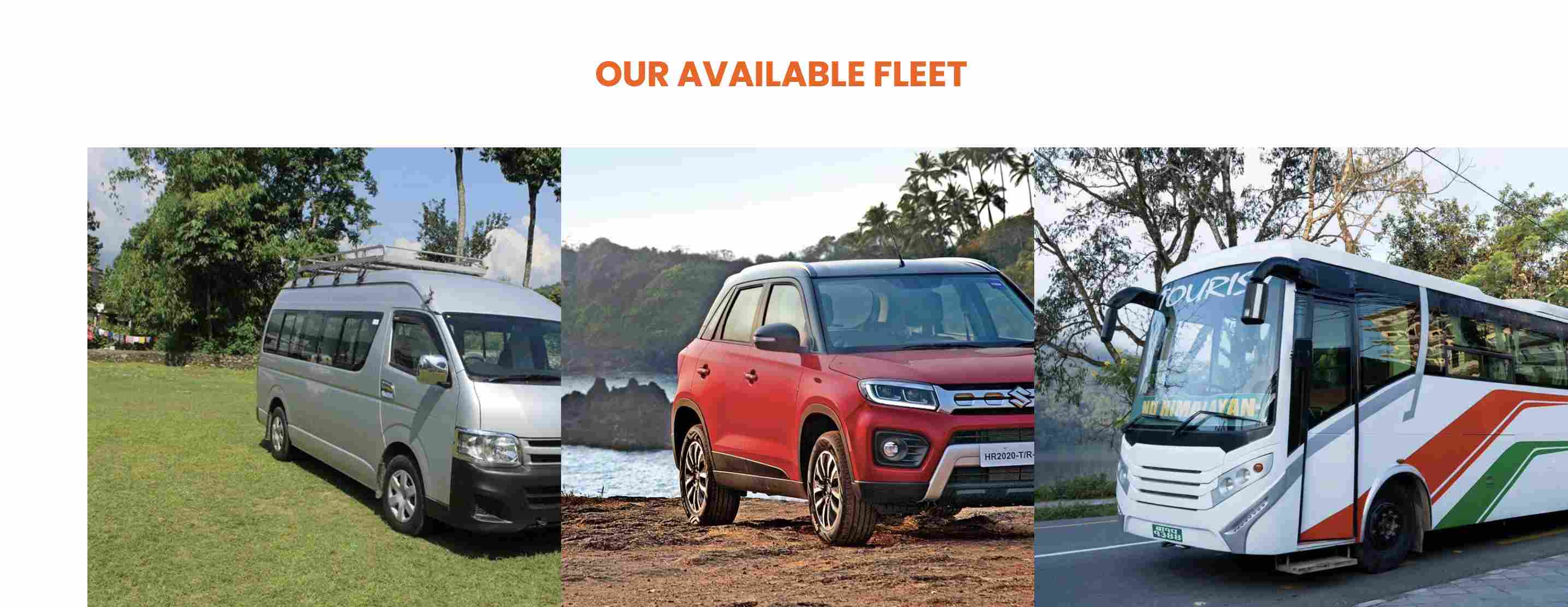
Sunauli → Pokhara: Tourist car, SUV, Hiace or suitable tourist vehicle
Pokhara → Muktinath: Private 4WD jeep
Large groups: Tourist vehicle to Pokhara + appropriate 4WD vehicles for the Mustang section.
Sunauli to Muktinath Quick Summary
| Item | Details |
|---|---|
| Starting Point | Sunauli–Belahiya Border |
| Ending Point | Muktinath, Mustang |
| Approx. Distance | 380–400 km |
| Starting Altitude | ~100 m |
| Final Altitude | ~3,800 m |
| Recommended Duration | 4–5 days |
| Main Gateway | Pokhara |
| Mountain Gateway | Beni |
| Major Stop | Tatopani |
| Mustang Gateway | Jomsom |
| Cultural Stop | Kagbeni |
| Final Destination | Muktinath |
| Recommended Upper Mustang Vehicle | 4WD Jeep |
| Best Road-Trip Seasons | March–May and October–November |
| Monsoon | Higher risk of landslides and road disruption |
| Winter | Possible snow/ice disruption at high altitude |
Sunauli to Muktinath, Sunauli to Muktinath road, Sunauli Muktinath distance, Sunauli to Muktinath by road, India to Muktinath by road, Muktinath road trip, Muktinath jeep tour, Pokhara to Muktinath, Jomsom Muktinath road, Muktinath altitude, Mustang road trip, Muktinath pilgrimage tour, Nepal India border to Muktinath